
 |
7th March 1948-7th March 2023.
Established on March 7, 1948 Macca celebrates the 75th anniversary of its foundation.
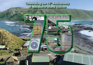 In the early hours of the morning of 7th March 1948, HMALST 3501 (later renamed HMAS Labuan) anchors at Buckles Bay, Macquarie Island 54° 29′ 56″ South, 158° 56′ 17″ East.
The ANARE team had arrived to establish a base that was to be permanently occupied for the next 75 years. The ANARE Club pays tribute to the 1306 men and women expeditioners who have wintered there during these 75 years.
The Voyage Leader of the 1948 Expedition, and Captain of the Ship, was Lieutenant Commander George Dixon
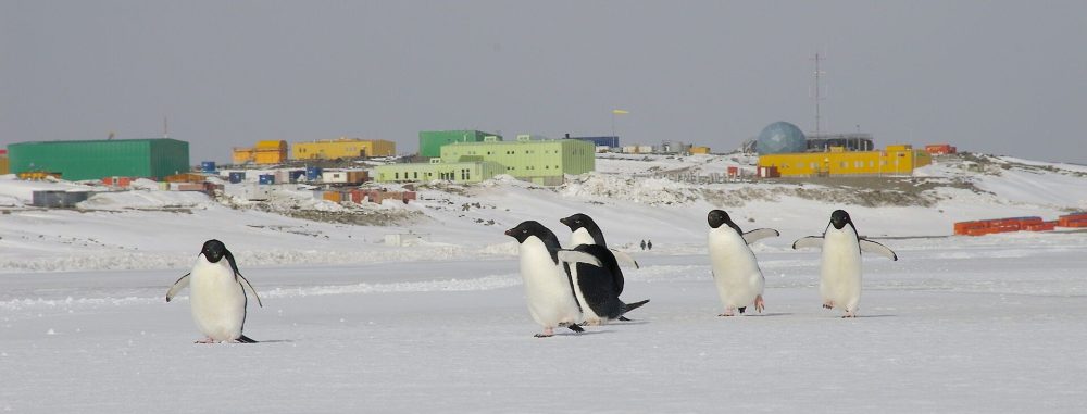
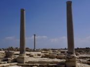
Macquarie Island is located half way between Tasmania and Antarctica and a Station was established on the “green sponge” in 1948. The Island was used as a half way point to establish the first radio link between Australia and Antarctica during Sir Douglas Mawson’s 1911 expedition.
The Macquarie Island Station (WAP AUS-Ø8) , commonly called Macca, is a permanent Australian Subantarctic Research Base, managed by the Australian Antarctic Division (AAD). The station lies at the base of Wireless Hill, between two bays on the isthmus at the northern end of the island.
To celebrate the 75th event, a special postage-paid envelope has been issued. Release date: 7 February 2023. See: Shop (auspost.com.au) and Australian Antarctic Program: 75 Years – Australia Post (australiapostcollectables.com.au)
7 mars 1948-7 mars 2023.
Fondée le 7 mars 1948, Macca célèbre le 75e anniversaire de sa fondation.
Aux premières heures du matin du 7 mars 1948, HMALST 3501 (plus tard renommé HMAS Labuan) jette l’ancre à Buckles Bay, Île Macquarie 54° 29′ 56″ Sud, 158° 56′ 17″ Est.
L’équipe ANARE était arrivée pour établir une base qui devait être occupée en permanence pendant les 75 prochaines années. Le Club ANARE rend hommage aux 1306 expéditionnaires hommes et femmes qui y ont hiverné durant ces 75 années.
Le chef de voyage de l’expédition de 1948 et le capitaine du navire étaient le lieutenant-commandant George Dixon
L’île Macquarie est située à mi-chemin entre la Tasmanie et l’Antarctique et une station a été établie sur ‘l’éponge verte’ en 1948. L’île a été utilisée comme point à mi-chemin pour établir la première liaison radio entre L’Australie et l’Antarctique lors de l’expédition de Sir Douglas Mawson en 1911.
La station de l’île Macquarie (WAP AUS-Ø8), communément appelée Macca, est une station subantarctique australienne permanente Base de recherche, gérée par la Division antarctique australienne (AAD). La station se trouve au pied de Wireless Hill, entre deux baies sur l’isthme à l’extrémité nord de l’île.
Pour célébrer le 75e événement, une enveloppe spéciale préaffranchie a été émise. Date de sortie : 7 février 2023.Voir : Boutique (auspost.com.au) et Programme australien de l’Antarctique : 75 ans – Australia Post (australiapostcollectables.com.au)
Info de la Source Publié * ICI

5X2I Uganda
2023-03-09 16:12:19
Pista, HA5AO will be active as 5X2I from Uganda, 24 April – 20 May 2023.
Version traduite via Google Translate
Pista, HA5AO sera actif en utilisant l’indicatif 5X2I depuis l’Ouganda, du 24 avril au 20 mai 2023.
3B8HE Mauritius
2023-03-09 14:05:27
Paul, G8AFC is currently active as 3B8HE from Mauritius, IOTA AF – 049.
Version traduite via Google Translate
Paul, G8AFC est actuellement actif en utilisant l’indicatif 3B8HE de Maurice, IOTA AF – 049.

VU4T Andaman Islands
2023-03-08 16:34:23
VU4T Team will be active from Andaman Islands, IOTA AS – 001, 2 – 5 March 2023. Team – VU3HPF, VU2JXN.
Version traduite via Google Translate
L’équipe VU4T sera active depuis les îles Andaman, IOTA AS – 001, du 2 au 5 mars 2023. Équipe – VU3HPF, VU2JXN.

9X5RU Rwanda
2023-03-08 20:13:27
9X5RU Team will be active from Rwanda, 22 March – 7 April 2023.
Team – R7AL, RW9JZ, RW8A, R9LR, R5EC, R5AF, RT9L, UA3QLC.
Team – R7AL, RW9JZ, RW8A, R9LR, R5EC, R5AF, RT9L, UA3QLC.
Version traduite via Google Translate
L’équipe 9X5RU sera active depuis le Rwanda, du 22 mars au 7 avril 2023.
Équipe – R7AL, RW9JZ, RW8A, R9LR, R5EC, R5AF, RT9L, UA3QLC.
5B/HA5PP Cyprus
2023-03-07 21:25:29
Zoltan, HA5PP will be active as 5B/HA5PP from Cyprus, IOTA AS – 004, in CQ WW WPX SSB Contest, 25 – 26 March 2023.
Version traduite via Google Translate
Zoltan, HA5PP sera actif en tant que 5B/HA5PP de Chypre, IOTA AS – 004, au concours CQ WW WPX SSB, les 25 et 26 mars 2023.
V31DX Belize
2023-03-07 17:35:36
V31DX, Hernan Urbina is active from Orange Walk, Belize.
Version traduite via Google Translate
V31DX, Hernan Urbina est actif depuis Orange Walk, Belize.

JW7QIA Svalbard Islands
2023-03-06 22:12:44
LA7QIA is currently active again as JW7QIA from Svalbard Islands, IOTA EU – 063.
Version traduite via Google Translate
LA7QIA est actuellement à nouveau actif en utilisant l’indicatif JW7QIA depuis les îles Svalbard, IOTA EU – 063.
DU1/SP5APW Philippines
2023-03-06 21:13:12
Jacek, DU1/SP5APW will be active from Marinduque Island, IOTA OC – 244, 9 – 14 March 2023 and from Calayan Island, IOTA OC – 092, 18 – 26 March 2023.
Version traduite via Google Translate
Jacek, DU1/SP5APW sera actif depuis l’île de Marinduque, IOTA OC – 244, du 9 au 14 mars 2023 et depuis l’île de Calayan, IOTA OC – 092, du 18 au 26 mars 2023.

FO/F6BCW Huahine Island French Polynesia
2023-03-06 19:05:40
Didier, F6BCW will be active from Huahine Island, IOTA OC – 067, French Polynesia, May – October 2023.
Version traduite via Google Translate
Didier, F6BCW sera actif depuis l’île de Huahine, IOTA OC – 067, Polynésie française, mai – octobre 2023.

TX7K Hiva Oa Island Marquesas Islands
2023-03-06 17:31:17
TX7K Team will be active from Hiva Oa Island, IOTA OC – 027, Marquesas Islands, 4 – 19 November 2023.
PS: Hello Claude. This is Didier F6BCW, the Team Manager of the DX’p Marquesas 2023 team, Nov 4 to Nov 19. This email to announce that DX’news and DX’world have made 2 errors that I am following are correcting the first: we haven’t requested a call sign yet, so I don’t know where the call TX7K was caught??????????? the second, a copy error in one of the calls of the team members, JOHN is F5VHQ ………..and not F5HVQ. The rest is OK. If you can correct it, that would be great. 73 Didier
PS: Hello Claude. This is Didier F6BCW, the Team Manager of the DX’p Marquesas 2023 team, Nov 4 to Nov 19. This email to announce that DX’news and DX’world have made 2 errors that I am following are correcting the first: we haven’t requested a call sign yet, so I don’t know where the call TX7K was caught??????????? the second, a copy error in one of the calls of the team members, JOHN is F5VHQ ………..and not F5HVQ. The rest is OK. If you can correct it, that would be great. 73 Didier
Version traduite via Google Translate
L’équipe TX7K sera active depuis l’île de Hiva Oa, IOTA OC – 027, îles Marquises, du 4 au 19 novembre 2023.
PS :Bonjour Claude. Ici Didier F6BCW, le Team Manager de l’équipe DX’p les Marquises 2023, nov 4 à nov 19.
Ce courriel pour vous annoncer que DX’news et DX’world ont commis 2 erreurs que je suit en train de faire rectifier, la première : nous n’avons pas encore fait le demande d’indicatif, alors je ne sais pas ou a été pêché le call TX7K ??????????? la seconde, une erreur de recopie dans un des call des membres de l’équipe, JOHN est F5VHQ ………..et non pas F5HVQ. Le reste est OK. S’il vous est possible de rectifier, ce serait sympa. 73 Didier
ZF2RJ Cayman Islands
2023-03-05 21:16:05
Joel, NF3R will be active as ZF2RJ from Cayman Islands, IOTA NA – 016, until 12 March 2023.
Version traduite via Google Translate
Joël, NF3R sera actif en utilisant l’indicatif ZF2RJ depuis les îles Caïmans, IOTA NA – 016, jusqu’au 12 mars 2023.

FT8WW Crozet Islands
2023-03-05 16:05:07
Thierry, FT8WW will be active until 18 or 19 UTC 6 March 2023. He will start activity again 13 March 2023.
Version traduite via Google Translate
Thierry, FT8WW sera actif jusqu’à 18 ou 19 UTC le 6 mars 2023. Il reprendra son activité le 13 mars 2023.
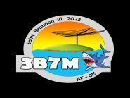
3B7M Saint Brandon Islands
2023-03-05 15:55:13
We reached 100,000 qso a while ago. Today it is very windy, and it got cold. A big storm is coming, and maybe we will QRT for a long time all night, perhaps even tomorrow.
Version traduite via Google Translate
Nous avons atteint 100 000 qso il y a quelque temps. Aujourd’hui il y a beaucoup de vent et il fait froid. Un gros orage arrive, et peut-être allons-nous
QRT longtemps toute la nuit, peut-être même demain.
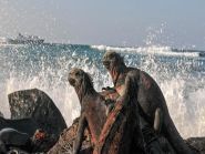
HD8M Santa Cruz Island Galapagos Islands
2023-03-05 15:48:43
HD8M Team will be active from Santa Cruz Island, IOTA SA – 004, Galapagos Islands, 1 – 11 March 2023.
Version traduite via Google Translate
L’équipe HD8M sera active depuis l’île de Santa Cruz, IOTA SA – 004, îles Galapagos, du 1er au 11 mars
 AmateurRadio.com
Une agréable surprise….

De temps en temps au cours de la semaine dernière, j’ai vu 3B7M dxpedition repéré sur le
DX Heat Cluster et la plupart du temps, soit je ne les ai pas entendus, soit ils étaient au niveau ou en dessous
du plancher de bruit. Je savais qu’ils étaient là car le pile-up était bel et bien vivant et répondait avec leurs indicatifs d’appel dans l’espoir de se retrouver dans le journal 3B7M.
Hier, ils ont été repérés sur 15 m à leur abreuvoir CW habituel de 21.005 et comme pour toutes les dxpedition, ils opéraient en split.
Info de la Source Publié * ICI
3B7M Saint Brandon Islands
2023-03-04 16:58:26
In log 80k QSOs.Problems with low bands. After a strong storm, the 80m vertical fallen.
Version traduite via Google Translate
En log 80k QSOs.Problems with low bands. Après un fort orage, les 80m de dénivelé sont tombés.
FT8WW Crozet Islands
2023-03-04 13:31:01
I received services from the Prefet of the TAAF the new convention me allowing me to start my HF activities under the conditions set by the IPEV.
Version traduite via Google Translate
J’ai reçu des services du Préfet des TAAF la nouvelle convention me permettant de démarrer mes activités HF dans les conditions fixées par l’IPEV.

AH2R Guam Island
2023-03-03 20:36:09
AH2R Team will be active from Guam Island, IOTA OC – 026, in ARRL DX SSB Contest, 4 – 5 March 2023.
Version traduite via Google Translate
L’équipe AH2R sera active depuis l’île de Guam, IOTA OC – 026, au concours ARRL DX SSB, du 4 au 5 mars 2023.